The Superstition Cauldron Complex
The immense, picturesque cliffs and
rugged pinnacles at the western end of the Superstition Mountains -- indeed, Superstition
Mountain itself -- are formed from massive layers of volcanic ash.
Between about 25 million years ago, and approximately 15 million years ago, a
number of monstrous volcanic eruptions occurred in the area of Arizona which now lies just
east of the town of Apache Junction.
Three of these huge volcanic features (see map below), which
now in popular culture would be called "supervolcanoes", reveal their former
outlines in the rocks of the area today.
Back then, during each event, as molten rock from the Earth's crust blasted
into the atmosphere, a void was created which then collapsed as a giant, roughly circular
crater, known as a "caldera".
On the order of 10 miles (16 km) to 12 miles (19 km) across, each caldera
exploded with a fury yet unseen in today's world. Volcanic ash fell from the skies
probably as far east as present-day Arkansas and Louisiana. In the vicinity of an
eruption itself, the ash was still white hot when it descended, ultimately fusing into a
rock we call "welded tuff".
It is this rock you see in this end of the Superstition Mountains.
Compositionally, it is called rhyolite or rhyodacite. For the most part, the outlines of the
calderas are not visible today, having been obliterated by millions of years of
erosion.
We know they were there, however, by mapping the rock formations and studying
the faults in the vicinity. The name "cauldron" is given to a caldera, the
outlines of which are no longer visible.
Although the Superstition Cauldron and the Goldfield Cauldron
show no surface topography, the younger Tortilla structure does show some visible
expression, and could be called the Tortilla Caldera. They are all
collectively known as the Superstition Cauldron Complex.
When you drive out the Apache Trail (SR88), from near the little tourist-trap
town of Goldfield (not far from Apache Junction), to almost the Fish Creek hill (you'll
know it when you start descending it!), you are venturing within the rims of the ancient
supervolcanoes, and all around you is the ash from those violent times.
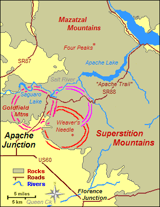
The western end of the Superstition
Mountains,
showing the locations of the three main structures.
Tortilla Caldera < 15 million years old
Goldfield Cauldron ~ 15 - 16 million years old
Superstition Cauldron ~ 25 million years old
This map is at the same scale as the main
Superstition Mountains Interactive Map.
Map and data is based on
"The Superstition Cauldron Complex",
by Michael F Sheridan, in the
Guidebook to the Geology of Central Arizona,
Special Paper Number 2, 1978, by the
Bureau of Geology and Mineral Technology,
State of Arizona, and the University of Arizona.
-------------------------------
If this window appears as a full-size,
rather empty-looking web page, either you do not have scripting and "pop-ups"
enabled in your web browser, or you have found it only by way of a search function.
In the former case, you can return to the main website by using your
"Back" button, or by accessing our Home Page at www.gemland.com.
In the latter case, you will have to access our website's Home Page by going
to www.gemland.com.
If this window appears as a
"pop-up", simply close
this window to return to where you were.
[060811]
|